Civil War Map June 1861 United States Confederate West Territories Pony Express


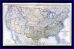
An Original Antique Map: Not a Reproduction! Atlas to Accompany the Official Records of the Union and Confederate Armies.
Currently Listing Many Civil War Maps and Prints. Check out my other items. Description: The map is from the. The title of the atlas appears in the top left margin and plate number in the upper right.
A copy of the title page is included with all the publishing details for authenticity. The atlas was published in a very limited context to be distributed to government officials in the three houses of government as a reference for assessing the Civil War.
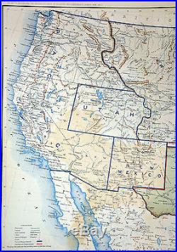
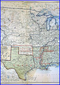
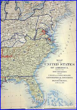
This is from the original first publishing, that lasted from 1891-5. It is a very interesting map showing the confederacy, dated June 30, 1861 on the map. Also interesting are the details of the military departments out west and the territory configurations.
Washington extends through Idaho, and the north central is labeled Dakota above an elongated Nebraska, Arizona is part of New Mexico, Oklahoma is labeled as Indian Territory. Size: The map image measures 16 by 27 inches on a page measuring approximately 18 by 29 inches with plenty of margin all around for framing.It is a full double page sheet as issued. Condition: The map is in Good condition for its age with overall light tonal aging, blank on the reverse with a centerfold as issued. The margins are slightly trimmed and there is some backprinting in the Texas and New Mexico area typical of these map, otherwise it is very clean with a strong impression and bright color that would frame up nicely. Pics are of the actual map. Be sure to add me to your favorites list.
The item "Civil War Map June 1861 United States Confederate West Territories Pony Express" is in sale since Sunday, April 30, 2017. This item is in the category "Antiques\Maps, Atlases & Globes\North America Maps". The seller is "c574778" and is located in Fairview, Pennsylvania. This item can be shipped worldwide.
- Type: Map
- Country Region: United States
- Subject: Military & War
- Topic: Civil War (1861-65)
- Country Of Manufacture: United States
